Adaptation case studies
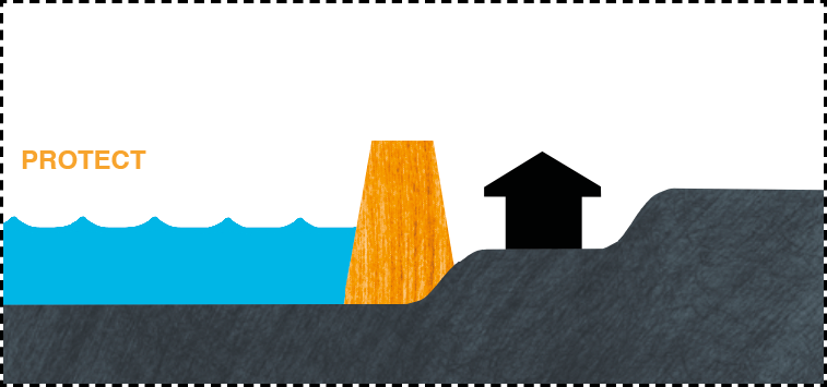
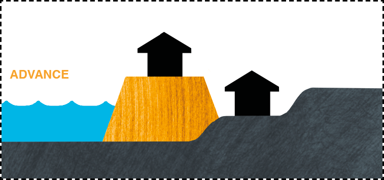
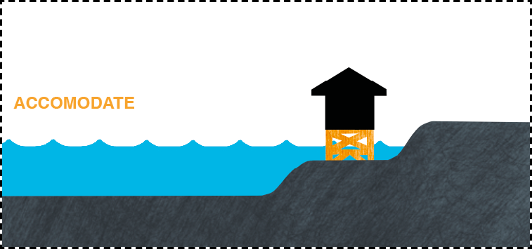
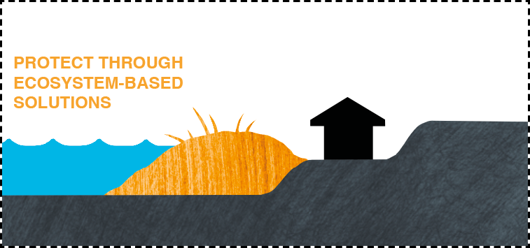
In face of rising sea levels, several adaptation measures can be implemented. Three different kinds of approaches are usually distinguished:
Hold the (coast)line through protection or advance
Accommodate the infrastructures
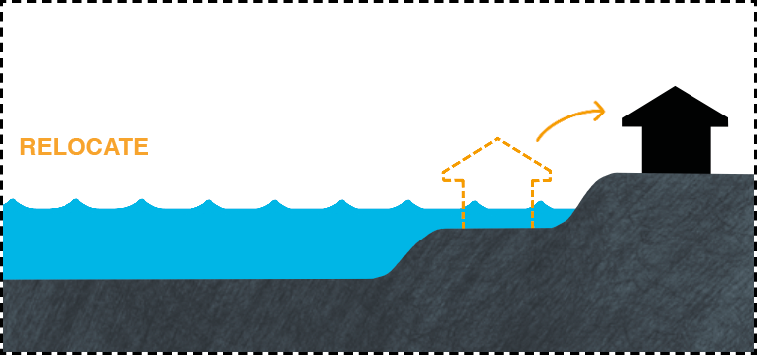
Support natural processes, through Nature-based solution or relocation
Explore three practical examples showcasing the use of the sea level projection tool to implement suitable adaptation measures.
Note that these are illustrative examples, not representing the adaptation measures for the entire countries mentionned.
France
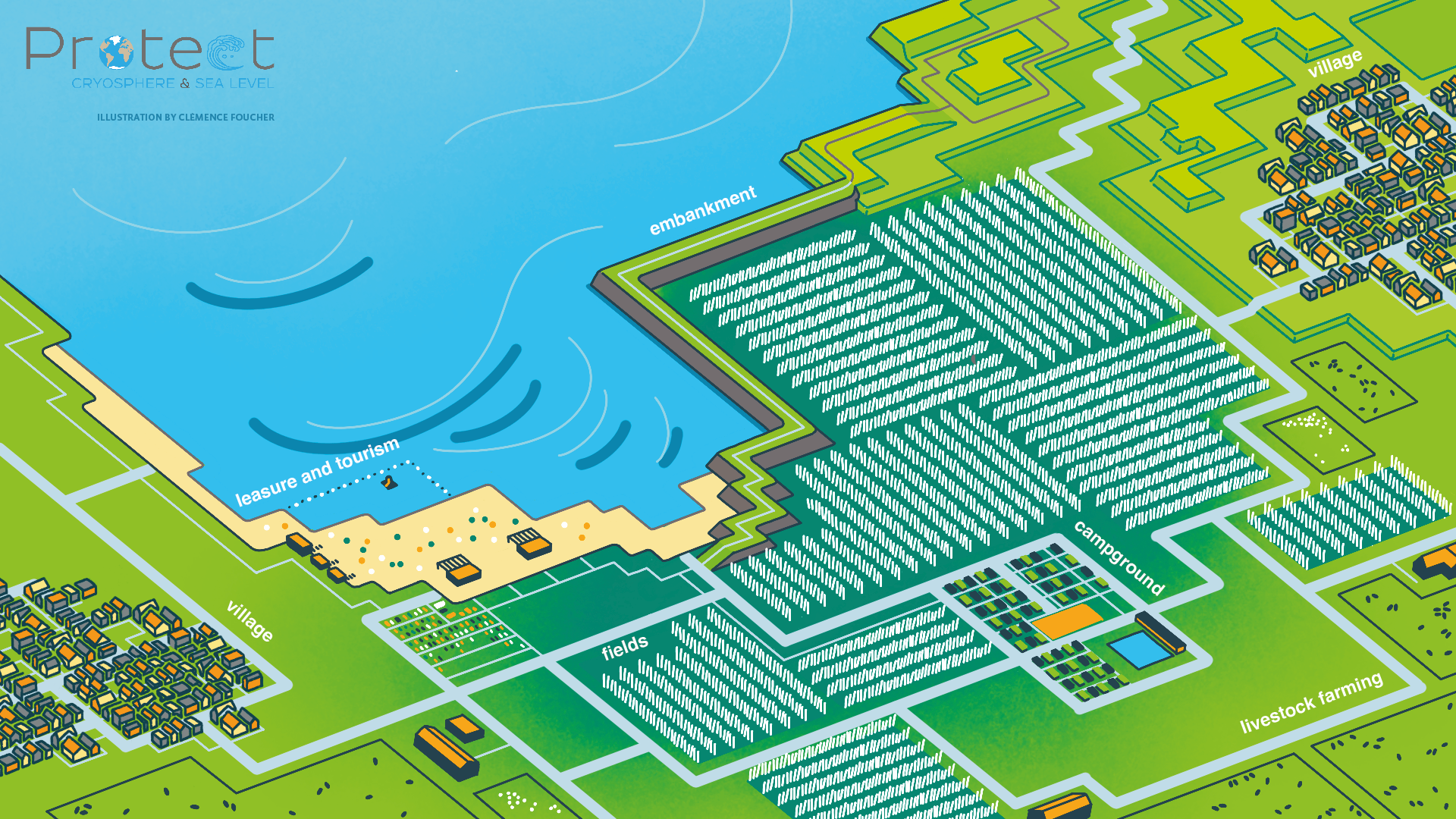
We are in France, in a small Normandy coastal community located in a low-lying area, exposed to erosion and periodic flooding during extreme events. The municipality consists of a village and a large amount of farmland and livestock. It also has tourism and leisure activities and infrastructures.
By 2050, because of sea-level rise and others impacts of climate change, the area will have to cope with a retreat of the coastline, as well as more frequent flooding. The village, situated on a small hill, is safe. On the other hand, the fields and leisure and tourist facilities on the seafront are the first to be affected by these changes.
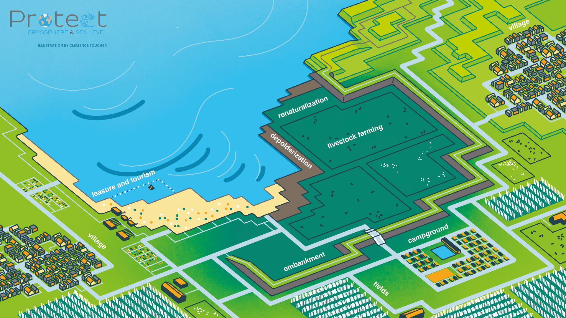
The French Coastal Conservatory Agency owns some land in the commune. It wishes to anticipate the rise in sea level by 2050, both on its current land and on the prospective purchased land - soon to be under threat, while supporting the whole area in this transition. After discussions with all the stakeholders - the town council, government services, technicians, farmers, fishermen, shopkeepers, leisure activities managers, primary and secondary residents -, a territorial project is taking shape. On the front of the municipality, on the land owned by the Coastal Conservatory Agency, the sea is given more space, by retreating and moving back the infrastructures and activities currently located there.
To carry out the project, the stakeholders need information on sea level rise: how far inland will the sea go in 2050? Which scenario should be chosen: catastrophic, optimistic, median? What impact will this rise have on land and activities? Based on the scientific information available, the Coastal Conservatory Agency and all those involved in the municipality can anticipate the retreat: the earth dam is dismantled, the fields are converted to extensive livestock farming, the campsite is moved back, and tourism and leisure activities are maintained and transformed in line with changes in the area.
2020 - With the existing adaptation measures
2050 - With the new adaptation measures
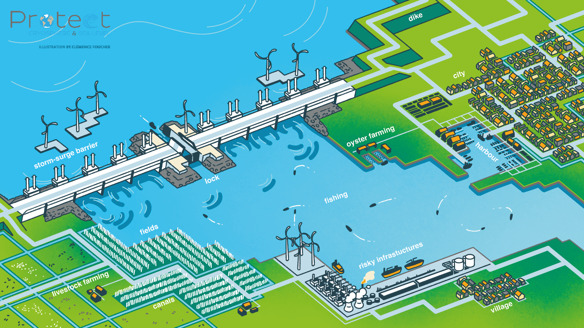
The Netherlands
Facing the sea stands a wide estuarine barrier: it protects the land below sea level from submersion, a situation that affects a large part of the Netherlands. These polders, which were reclaimed from the sea from the 13th century onwards, have seen the development of numerous activities, attracting a large and dynamic population: agriculture and livestock farming, fishing and oyster farming, tourism, industrial port infrastructures and urban development. Numerous canals square the landscape, both in towns and fields.
These populations and activities are particularly vulnerable to flooding in the event of a storm, a situation that affected the Netherlands in 1953 with several thousand deaths and immense damages. The estuary barrier was built after that storm to prevent such an event from happening again. It is a substantial infrastructure of several kilometres long: gates allow water to pass through to maintain the natural hydrological functioning. In the event of storms, the gates close and cut off all flow between the sea and the river, preventing too much seawater from flooding inland.
With climate change and sea-level rise, questions arose about the management of this infrastructure. It can still protect the land with several tens of centimetres of rise, but this means that it will have to close its locks more often. What impact will these frequent closures have on inland ecosystems? On fishing and oyster farming? On the arrival of sea sand to compensate for riverbank erosion? What are the consequences for maintenance work on the barrier and the solidity of the infrastructure if it is used more often? To answer these questions, stakeholders need precise, local sea-level rise scenarios for 2050.
Given the vulnerability of people and infrastructure in the Netherlands, some managers also want to prepare for the "worst case" scenario for 2100 and 2150. What maximum sea level rise can they withstand? At what point will estuary barriers no longer suffice? How can activities and populations be maintained in low-lying areas without endangering them? Stakeholders can rely on the climatic information available, but they will also need to keep abreast of developments in knowledge about sea-level rise in order to adjust their management plans over the coming decades.
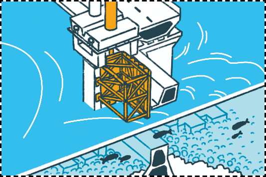
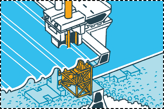
A large-scale infrastructure to protect a wide range of activities
Barrier open
Barrier closed
The Maldives
In the Indian Ocean lies the Republic of the Maldives, a small archipelago consisting of more than 1000 islands, 188 of which are inhabited. Internationally, the Maldives attracts high-end tourists with its tropical islands, sandy beaches and vibrant coral reefs. The islands of the Maldives are low-lying, ranging from 0.5m to 2.3m above sea level, which, combined with future sea level rise, poses a challenge in terms of frequent coastal flooding.
The Maldives has a history of coastal adaptation, often involving land reclamation. The most prominent example is the artificial island of Hulhumalé, which has been raised 1.8-2.0m above mean sea level and is home to 66,000 people. A new reclamation project wants to take future sea-level rise into account. The planners need the following information: How high should the new island be reclaimed? When can we expect a sea level rise of 50 cm and 100 cm?
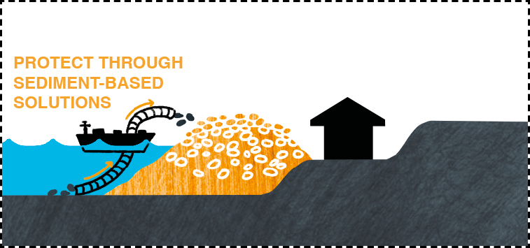
If planners want to adapt existing islands to cope with future sea-level rise, they could also explore novel approaches. An island could grow vertically with sea level rise if it is frequently flooded, resulting in sediment transport on the island. Buildings and infrastructure on the island would then need to be well adapted to withstand frequent flooding. Such nature-based solutions could be an alternative to traditional hard defences such as sea walls. Planners need to answer questions such as: Can we design islands that can grow vertically as sea levels rise? Can they grow fast enough to keep up with sea level rise? And how can we protect buildings and infrastructure from frequent flooding?
Various adaptation strategies for the Maldives 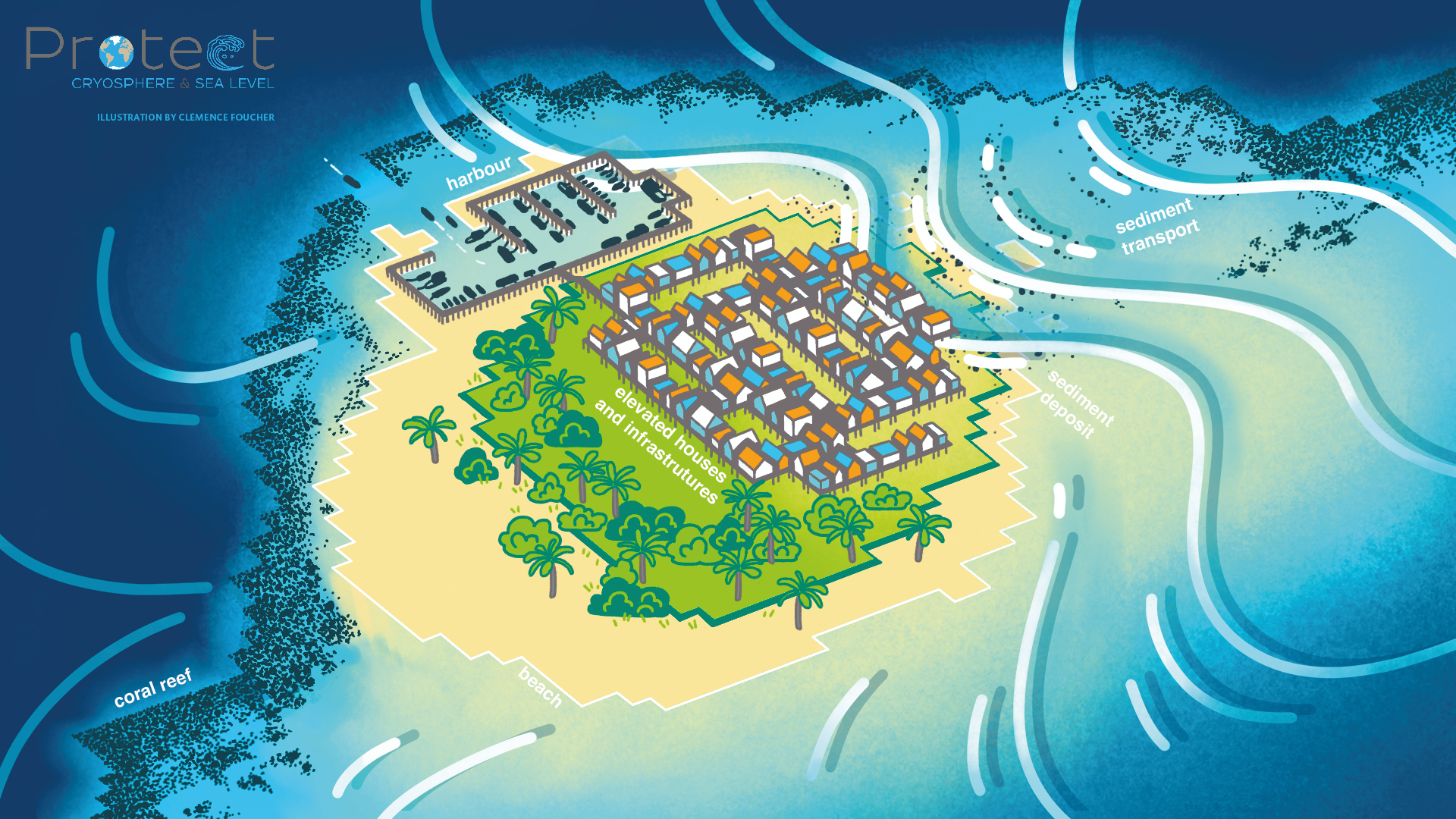
Using accommodation to naturally elevate coral islands to adapt against rising sea levels: Houses and infrastructure on the coral reef island are built on stilts to withstand frequent flooding. As the island is flooded, sediment from the coral reef is deposited onto the island, enabling it to grow vertically alongside sea level rise.
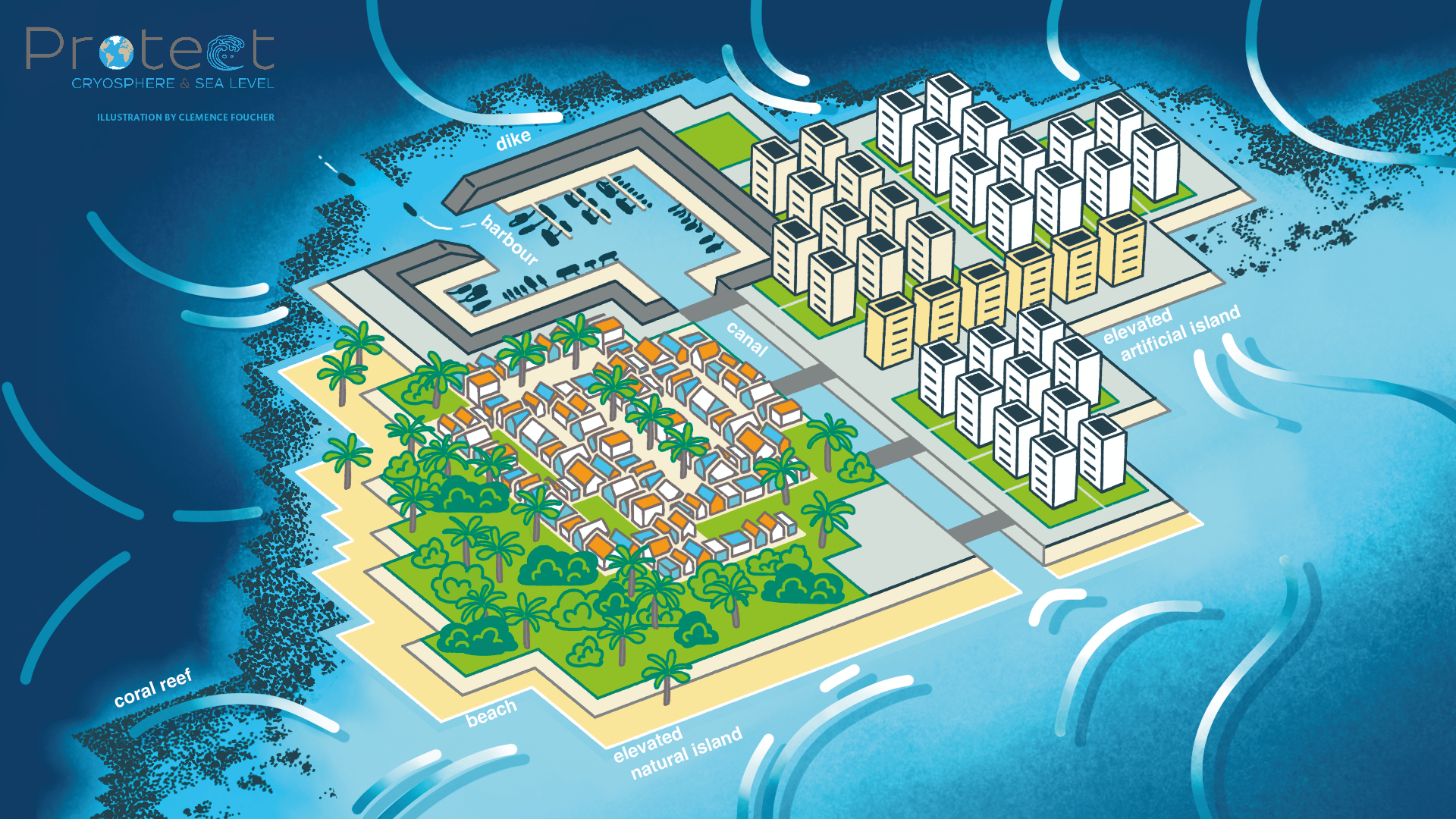
Using land reclamation to create a new island, or to expand an existing one: An artificial island is reclaimed onto the sea with a higher elevation than existing coral islands to adapt against future sea-level rise.
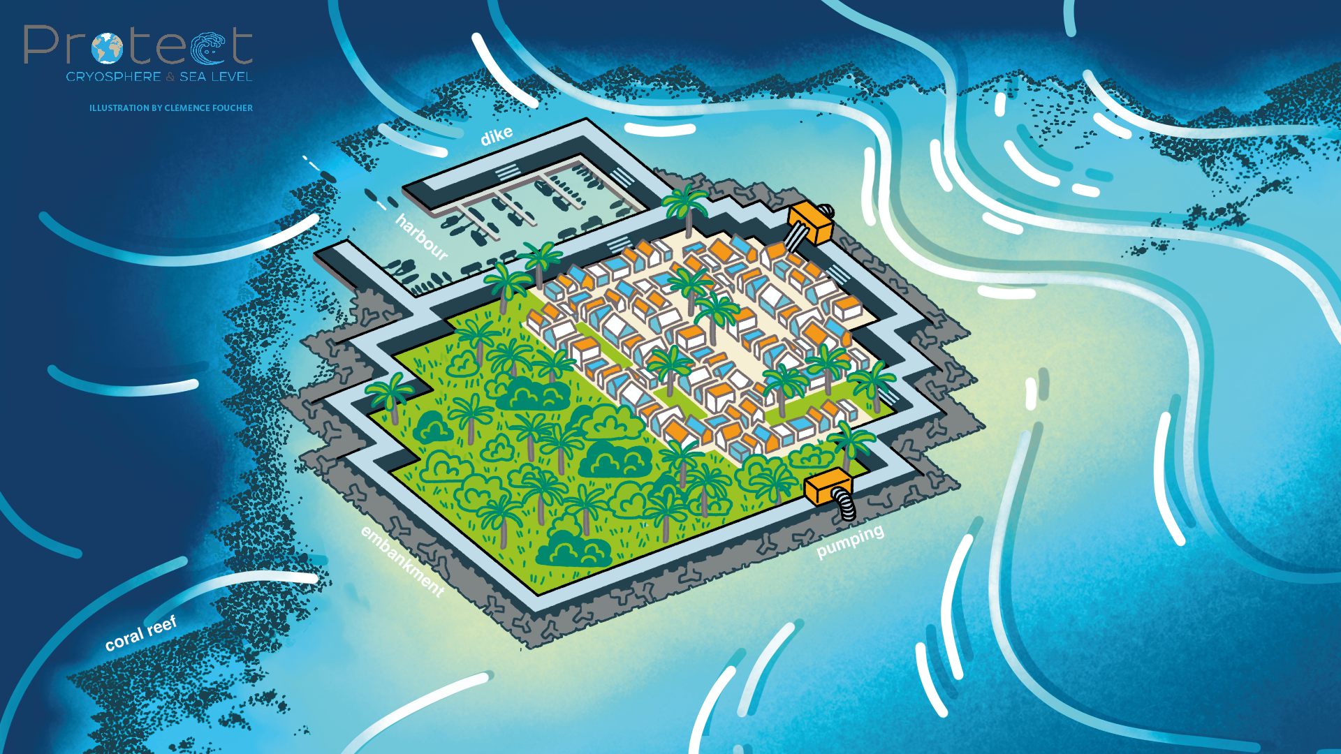
Using protection to adapt to sea level rise: An existing coral island is surrounded by sea walls or dikes to prevent flooding, while water pumps remove excess rainwater and high groundwater, discharging it back into the ocean.
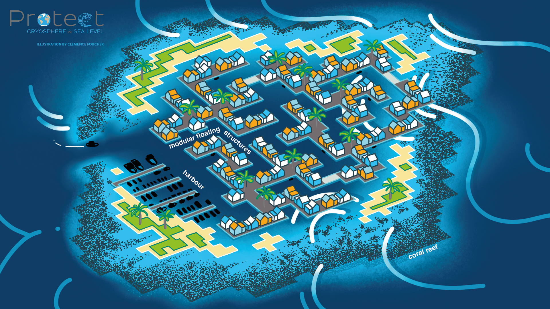
Using accommodation to adapt a coral island: Modular, floating houses and infrastructures are designed to withstand future sea-level rise and flooding, ensuring long-term resilience.